


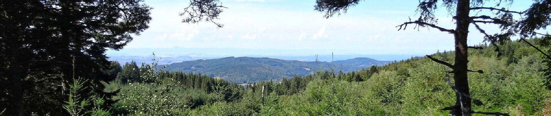
Brugeron_Puy_Gros

jagarnier
User GUIDE
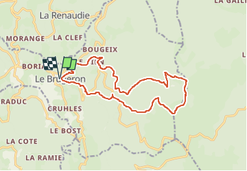

Length
16 km

Max alt
1426 m

Uphill gradient
637 m
Km-Effort
24 km

Min alt
837 m

Downhill gradient
636 m
Boucle
Yes
Creation date :
2024-08-15 13:48:54.493
Updated on :
2024-08-16 13:12:51.657
4h45
Difficulty : Difficult

FREE GPS app for hiking
 SityTrail
IGN / Geographical institutes
SityTrail Plus
The world is yours!
About
Trail Walking of 16 km to be discovered at Auvergne-Rhône-Alpes, Puy-de-Dôme, Le Brugeron. This trail is proposed by jagarnier.
Photos

Positioning
Country:
France
Region :
Auvergne-Rhône-Alpes
Department/Province :
Puy-de-Dôme
Municipality :
Le Brugeron
Location:
Unknown
Start:(Dec)
Start:(UTM)
555987 ; 5062330 (31T) N.
Comments